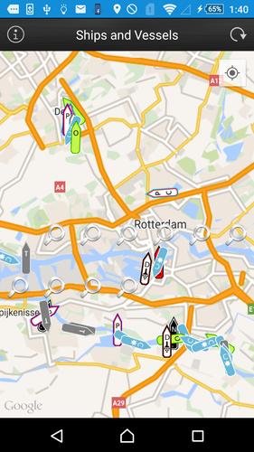

Find Ships and Vessels in your area or worldwide.
This app presents allows users to locate Ships and Vessels live on a map.
Just open the app, let it find your location and press the refresh button.
Jika ada kapal di dekatnya dengan transponder AIS yang sesuai dan stasiun penerima di jaringan kami mengambilnya, Anda harus dapat melihat kapal di peta.
See the following ship/vessel details:
Perbarui waktu
MMSI number
IMO number (Internation Maritime Organisation)
Ship Type (Passenger, cargo, pleasure, dive, military and many more)
Navigational status (under way, berthing, moored and many more)
Rate of Turn (when available)
Speed (kts)
Kursus
True Heading
Special Maneuvres
Latitude and Longitude
Destination port (call of port) when available
ETA (Estimated Time of Arrival) when available
Vessel Length (meters)
Vessel Width (meters)
Vessel Draught (meters)
To Bow (from AIS transponder)
To Stern (from AIS transponder)
To Port (from AIS transponder)
To Starboard (from AIS transponder)
We hope you enjoy the app please leave a good rating in order to keep us improving the app.
Memperluas
Waktu rilis
ukuran
kategori
Bepergiannama paket